
Conversational Analytics
Executives type questions as if talking to an analyst and get numbers and charts instantly.
AI turns questions into data queries and explains where every number comes from.See details ›See customers, branches, assets and field work on one map.
Go ahead and try it. This screen simulates the system with sample data.
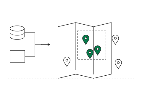
Pin data from every system on the map and filter by area
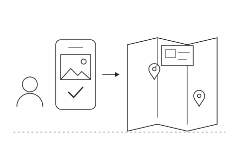
Field teams update status and photos on site
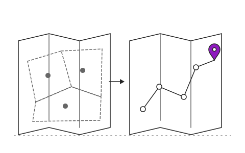
Analyze sales territories, service points or work routes
Organisations with customers, branches or assets across the country usually keep location data in different places: customer lists in the CRM, assets in the maintenance team's Excel, field work in LINE groups. When an executive asks where to open the next branch or which assets fail most often, nobody can see the whole picture on one map.
Location Intelligence (GIS) pins data from every system on a single map, including customers, branches, assets and field work, filtered by province, district or radius. Field teams update status and photos on site from their phones. The AI analyses sales territories, service points and work routes and points out which areas to act on first, with the reasons.
After go-live, executives see the geographic picture on one page, field teams spend less time travelling because routes are planned from the real map, and planners decide on new branches or resource allocation from data rather than intuition. Khaojai IT designs the GIS system around your organisation's work and connects it to your existing CRM, ERP, maintenance system and databases.
It depends on the number of data layers and whether coordinates are ready, typically 2 to 4 months. If your records only have addresses, the system can geocode them first.
Yes. It pulls data from CRM, ERP, maintenance systems and Excel files with coordinates or addresses, supports Shapefile and GeoJSON, and can use Google Maps or OpenStreetMap as the base map.
Field teams use it on their phones: pick a job on the map, update the status and attach photos in a few steps. It records offline when there is no signal and syncs when back online.
You control who sees which data layers and which areas. Customers' personal data is shown only to authorised users, access is logged, and the system can run on your own servers or on cloud infrastructure in Thailand.
AI in this system
Describe the problem your organisation faces. Our team and AI will recommend the right software and help you think it through.